
Conservation Force
A Force for Wildlife Conservation


Land Trust Division - Conservation Easements


The oldest cypress tree in Louisiana and the largest live oak in Orangeburg County, South Carolina (Both are on easements held by Conservation Force).
Program Purpose
Conservation Force's primary mission includes the conservation of wild places, wildlife, and an outdoor way of life. Thus, Conservation Force is a land trust. We hold conservation easements to maintain wild places in their natural condition for wildlife on private lands. We also hold mitigation bank easements to restore and protect the natural, scenic, or open space values of land. View the Conservation Easements brochure.
Why do we do this? For the same reason, we are a conservation organization. We are saving land for hunters now and in the future. Hunting cannot be saved, much less game to hunt, without saving the habitat necessary for both. Habitat is essential. It is the root of all biodiversity.
I have a home all to myself; it is nature.
- Henry David Thoreau, Journal, January 3, 1853
It is the end of a family when they begin to sell the land. Out of the land we came and into it we must go, and if you will hold your land you can live.
- Pearl S. Buck, The Good Earth, 1931
To leave something in "the woods" for our children we must pass-down "the woods."
- Chrissie Jackson
Conservation Force is a Patron of the Louisiana Wildlife and Fisheries Foundation and John J. Jackson, III is a founding board member and past president of that foundation. It too holds select conservation easements within the State of Louisiana.
We have expanded into other states and hope to expand in foreign lands that have legal provisions for conservation easements. The easements are created by donating development rights on private land to a non-profit, public charitable organization such as Conservation Force. The donation of these rights is a tax-deductible, charitable contribution for the landowner and serves wildlife conservation and the public good by preserving and/or restoring the land to its wild state forever. To date, many of Conservation Force's land and easement holdings are on rivers, streams, and waterways. That fits well with the Scenic River Act that was designed to help preserve valuable river borders, and with recovery efforts for the "threatened" listed Louisiana black bear. Conservation Force has long been a member and partner of the Louisiana Black Bear Conservation Committee, which was selected and cited as a model at the White House Conference on Cooperative Conservation.
See what National Wild Turkey Federation thinks..

See what the Congressional Sportsmans Foundation says about Conservation Easements...


Conservation Force continues to develop its land trust division. More private landowners are considering donation of conservation easements to Conservation Force. We can also serve as a land trust for organizations that support us and desire or need to partner to save habitat.
In August 2008, the Delta Land Trust added to that growth by making a $10,000 contribution to Conservation Force in a ceremony at the Louisiana Department of Wildlife and Fisheries in Baton Rouge. Delta Land Trust is a long-established easement bank in Arkansas, Mississippi, and Louisiana where Conservation Force's land holdings and easements presently exist.
Delta Land Trust

Delta Land Trust making contribution to Conservation Force
Map of Conservation Force Easements

-
La Petite Riviere (31.1658289, -91.932806)
-
Dugas Waterfrontage (31.1863611, -91.9126361)
-
Tangipahoa River Island and Shoreline (30.405008, -90.325513)
-
Virginia Bruns Marshall (30.894013, -91.383977)
-
Copper Mill Bayou (30.6800500,-91.1465250
-
Comite Flats I (30.6640611, -91.0694722)
-
Comite Flats II (30.6703167, -91.071927)
-
Acadian Haynesville (31.199624, -92.446775)
-
Bluffs Nature Reserve I (30.793498, -91.249051)
-
Bluffs Nature Reserve II (30.8019028, -91.2584611)
-
Bluffs Nature Reserve III (30.800326, -91.257605)
-
Bluffs Nature Reserve IV (30.804780, -91.249628)
-
University Lakes (30.408653, -91.160753)
-
Tunica Hills (30.89265, -91.494999)
-
Derrymore Plantation I: Hickory Hill Plantation(30.9525789, -91.150231)
-
Derrymore Plantation II: North 67 Conservation-(30.867863, -91.195244)
-
Derrymore Plantation III: Hatfield 54 Tract-(30.92805,-91.15123)
-
Zachary Mitigation Area: Redwood Creek(30.699077,-91.113825)
-
Gulf Coastal Plains (29.655015,-94.411883)
-
Enterprise Woodlands (29.853188, -90.887189)
-
Lucky Hit Woodlands-(30.009438, -91.018336)
-
Bad Bayou-(30.704323, -91.835273)
-
Big Darbonne-(30.627252, -91.867320)
-
For the Five-(30277104, -91.79816)
-
Copper Mills Nature Reserve(30.629591,-91.187401)
-
NAPREL Family Reserve-(30.917585,-92.202143)
-
Ratliff Woodlands Plantation-(29.95333,-91.00203)
-
Lexington Plantation-(30.28400,-91.173500)
-
Bossier City/ Barksdale-(32.431303,-93.589954)
-
Wesson Mitigation-(31.746266,-90.412472)
-
The Sanctuary Farms ((30.3881597, -90.9795528)
-
Hammer Creek (30.784970821262124, -91.2613588506268)
-
Diamond Island/ CHARTED (32.236130, -91.021647)
-
Cattle Creek, South Carolina (33.263451,-80.734148)
-
Palmetto I (30.782581, -91.862499)
-
Palmetto II (30.796065225064538, -91.84284172214761)
-
White Oak Farm (32.0217079772499, -90.64640720242298)
-
Jacob Audubon Easement (30.76630, -91.30756)
-
Carter Plantation (30.41129142148397, -90.57447462669886)
-
Jarreau River Road Estate (30.315928380444277, -91.12534846934825)
-
River Road Estate
-
Chris Cazaux Covington Tract (30.4782, -90.16364)
-
Sweet Lake-Moran Easement (30.0035, -93.1677)
-
Fabre-Bayou Sara Conservation Easement (30.842683, -91.400629)
-
Robicheaux Easement (32.103340, -93.676958)
-
Coteau Farms (30.392433501496704, -92.05683795883498)
-
Geaux Properties-Lindsey/Sligo-Lake Mound Road (30.9706662,-91.3679075)
Amite River Basin Easement Umbrella
48. Ewell Track (30.7320, -91.1282 )
49. Hunt Track (30.679861, -91.070791)
50. Joor Road Track (30.616929, -90.045349)
51. Milldale Site 1/ Forbes (30.6458, -91.0555)
52. Milldale Site 2/ Harp (30.643967, -91.053446)
List of Land Conservation Easements
This easement is in the Atchafalaya River Basin and the Petite Riviere is a tributary of the Red River. The property is located approximately eight miles northeast of Marksville and between Lake Ophelia National Wildlife Refuge and five Louisiana State Wildlife Management Areas. The area includes oak/hickory forest with cypress swamps, lakes, and waterways. The easement includes a contiguous tract and then three largely riparian tracts that connect import wildlife areas.
La Petite Riviere Conservation Easement
704.49 Acres (1999) located in Avoyelles Parish, LA (31.1658389, -91.9342806)

La Petite Riviere


The La Petite Riviere Conservation Easement is located between Lake Ophella National Wildlife Refuge and Spring Bayou State Wildlife Managment Area
Dugas Waterfrontage Conservation Easement
221.96 Acres (1999) located in Avoyelles Parish, LA (31.1863611, -91.9126361)
Tracts 1, 2, and 3 total 221.96 acres. The three tracts help fill a missing link in the corridor between Lake Ophelia NWR and Spring Bayou WMA. The servitude also helps with recovery of the "threatened" Louisiana black bear. The Black Bear Conservation Committee is partnering with the landowner and has planted 130 acres of hardwood seedlings in the area.

The three tracts of the Dugas Waterfrontage Conservation Easement are located beside Lake Ophelia National Wildlife Refuge
1. Tract 1 is contiguous to over a hundred acres of land enrolled in the Wetlands Reserve Program.


2. Tract 2 is contiguous to the Lake Ophelia NWR, which contains over 17,000 acres of publicly owned land dedicated to conservation.


3. Tract 3 is contiguous to 192.6 acres of land that is enrolled in the Wetlands Reserve Program. The WRP acreage is in turn contiguous to 704.49 acres of land subject to a conservation easement in favor of Conservation Force.


Tangipahoa River Island & Shoreline
4.760 acres (2001) located in Tangipahoa Parish, LA
(30.405008, -90.325513)
This is a cypress swamp just above Lee's Landing, owned in full by Conservation Force.


Virginia Bruns Marshall Conservation Easement
295.31 acres (2007) located in St. Francisville, West Feliciana Parish, LA (30.894013, -91.383977)
This easement stretches between Big Bayou Sara Creek and U.S. Highway 61. This is indivisible family land held for generations, bordering Myrtles, Greenwood, and Butler Plantations. It is part of the loessal bluffs created by the dust storms of the Glacial Period, which swept in silt from the western plains. These bluff lands offer a diverse habitat that supports some species of plants and animals not found elsewhere in Louisiana.


Family Cemetery
.jpg)
Feb. 2023

Chrissie Jackson and Bob Butler, Feb. 2023
Zachary Mitigation Area Copper Mill Bayou Conservation Easement
72.268 acres (2009) located in East Baton Rouge Parish, LA
(30.6800500, -91.1465250)
In a mitigation bank, land is frequently returned from a cultivated state to its natural state. This parcel was converted from cleared land to hardwood forest. This parcel borders Copper Mill Bayou and part of the Amite River Watershed. As easement holder Conservation Force ensures the land is converted then maintained in its natural state.

Zachary Mitigation Area Comite Flats I Conservation Easement
100.756 acres (2010) located in East Baton Rouge Parish, LA
(30.6640611, -91.0694722)
Spruce-pine hardwood flat and bottomland hardwood forest restoration in the Amite River Basin.


Zachary Mitigation Area Comite Flats II Conservation Easement
107.438 acres (2010) located in East Baton Rouge Parish, LA
(30.6640611, -91.0694722)
Bottomland and hardwood forest restoration in the Amite River Basin.


Bossier City/ Barksdale Easement
294.494 acres (2010) located in Bossier Parish, LA
(32.427875771, -93.58656874)
The easement is adjacent to the South Bossier Park and near the Red River National Wildlife Refuge on the Red River.


Acadian Haynesville Extension Easement
176.1 acres (2010) located in Rapides Parish, LA (31.199624, -92.446775)
This easement has been planted with cypress and tupelo trees.


The Bluffs I, II, III, IV Nature Area
453 acres (2010, 2011, 2017 and 2019) located in Thompson Creek, West Feliciana Parish, LA
We have accepted several easements from Dodson & Sons in Baton Rouge, which will preserve the beautiful natural qualities of land along the Thompson's Creek. The grantor explained his desire to donate the easements in the following email:
Dear John:
Thanks for your e-mail and all your assistance with the two conservation easements [at the time now there are 3]. I sincerely appreciate all you and your wife have done to make these easements possible. I think they have helped West Feliciana Parish immensely, along with The Bluffs subdivision. My entire family feels good knowing that these two tracts of approximately 170 acres will eventually be a forest on the banks of Thompson's Creek.
To give full credit where credit is due, you need to thank your brother Bob who introduced me to conservation easements several years ago. At that time, I became fascinated with the idea that one could be responsible, do something good for a community and at the same time obtain a tax benefit.
Again, I appreciate your diligence in handling the easements on behalf of Conservation Force, along with all you and your family have done in assisting me.
Happy New Year
With kindest regards,
Richard J. Dodson, 2011


Bluff I • 99.12 acres • 2010
30.793498, -91.249051

Bluff II • 54.47 acres • 2011
30.8019028, -91.2584611

Bluff III • 112 acres • 2017
30.8019028, -91.2584611

Bluff IV • 188.97 acres • 2019
30.804780, -91.249628

Bluffs IV is a recreational open space in West Feliciana Parish, Louisiana, along Thompson Creek. The easement has been established to forever protect the natural scenic and aesthetic value of the land
University Lakes Urban Reserve 14.63 acres (2010) located in East Baton Rouge Parish near Louisiana State University
(30.408653, -91.160753)
This easement has an elevated footpath for residents, a lake with largemouth bass, and several dozen bird species.


South Carolina Cattle Creek Conservation Easement
1,000+/- acres located in Orangeburg County, SC
(33.263451, -80.734148)
The property has mature bottomland hardwoods and the largest live oak in Orangeburg County, SC. Further, the easement protects a portion of the Cattle Creek watershed which feeds into the Edisto River. The Edisto River, known as one of the longest free-flowing blackwater rivers in North America, eventually empties into the Atlantic Ocean. It is the longest and largest river system completely contained within the borders of South Carolina. The Edisto River is one of the drinking water sources for the Charleston, SC area.

Tunica Hills Fisher Place Conservation Easement
402.93 acres (2011) located in West Feliciana Parish, LA
(30.89265, -91.494999)
Senator Tom McVea's tract in Tunica Hills, northwest of St. Francisville. It is bisected by Polly Creek which runs into the Mississippi River. This site contains southern mesophytic forests and is in the range of "threatened" Louisiana black bear.


Derrymore Plantation I: Hickory Hill Plantation Conservation Easement 104.01 acres (2011) located in East Feliciana Parish, LA
(30.925789, -91.150231)
The forest is classified as a mixed hardwood-loblolly pine. The forest type provides significant wildlife benefit to a wide range of native mammals, birds, and herptiles.


Zachary Mitigation Area Redwood Creek Addition Conservation Easement
290.633 acres (2013) located in East Baton Rouge Parish, LA
(30.699077, -91.113825)
This site is surrounded by wet hardwood flatwoods and bottomland hardwood


Gulf Coastal Plains Wetland Mitigation Bank Conservation Easement
464 acres (2013) located in Chambers County, TX
(29.655015, -94.411883)
This is the first wetland mitigation bank in Texas. It is located slightly east of Galveston Bay. Phase One is 464 acres adjacent to Anahuac National Wildlife Refuge. Ultimately it will be 1,850 acres of restored coastal wetlands.

A before and after video of Gulf Coastal Plains Wetlands Mitigation Bank, drone footage courtesy of Ecosystem Renewal.

The Gulf Coastal Plains Wetlands Mitigation Bank is located in-between the Anahuac National Wildlife Refuge (light green on the map).
Celebrating The Completion of Phase 1 of The Gulf Coastal Plains Wetlands Mitigation Bank- March 2017
Ecosystem Renewal and The Earth Partners have recently completed Phase 1 of the 1998-acre Gulf Coast Plains Mitigation Bank located in Chambers County. The bank is the largest herbaceous wetland and the only tidal wetland bank in the state of Texas.
Phase 1 consists of 464 acres adjacent to the Anahuac Wildlife refugee. No small undertaking, the restoration work completed to date includes the planting of over 300,000 native plants, the redistribution of several hundred thousand yards of earth, and the re-establishment of a mile-long natural tidal channel. Ecosystem Renewal and The Earth Partners have recently completed Phase 1 of the 1998-acre Gulf Coast Plains Mitigation Bank located in Chambers County. The bank is the largest herbaceous wetland and the only tidal wetland bank in the state of Texas.
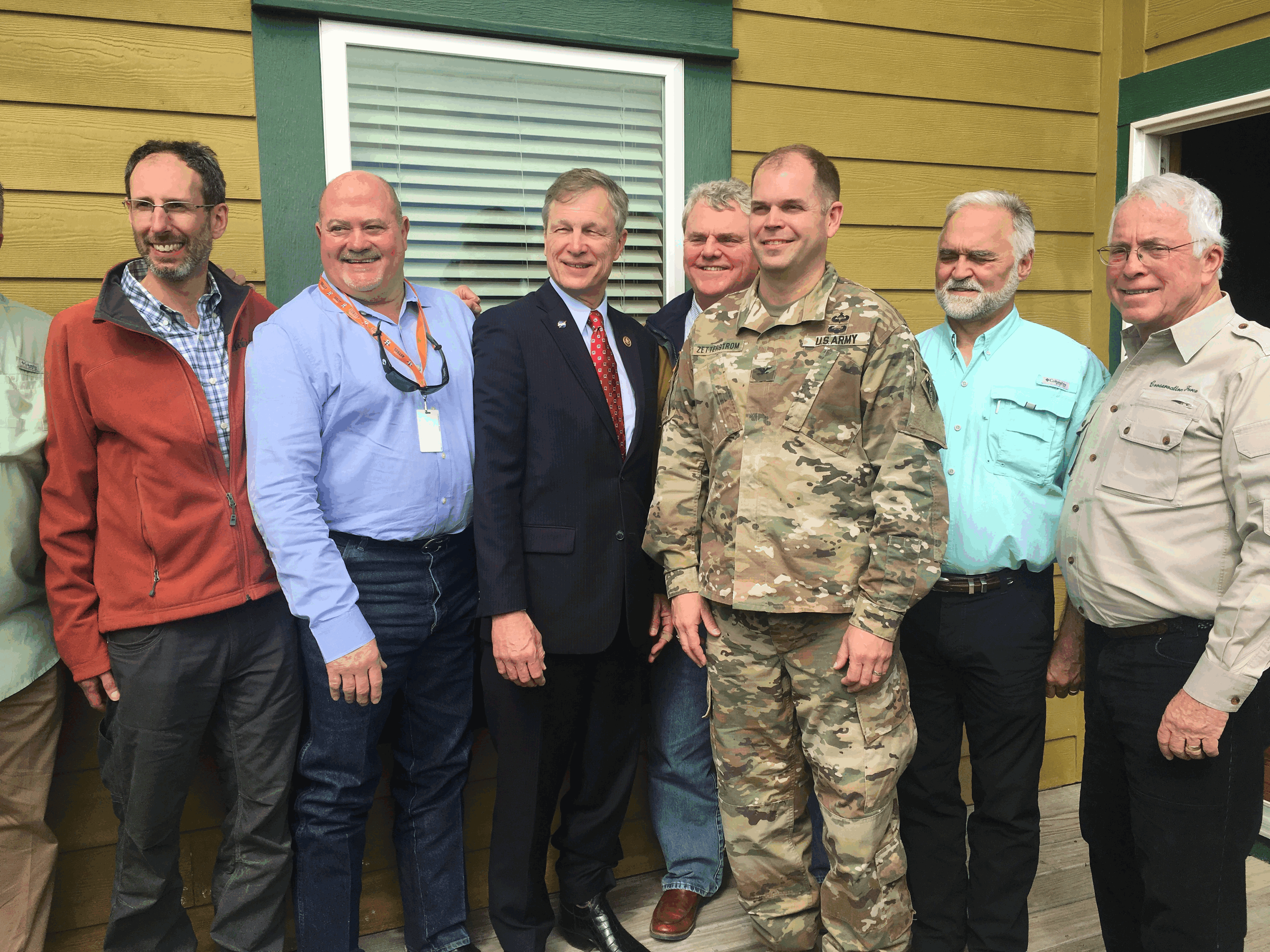
In addition to Representative Babin, Chambers County Officials and Members of the Interagency Review Team will also be in attendance to discuss the ecological and economic importance of the Bank to the surrounding community.
Enterprise Woodlands Plantation Mitigation Bank Easement
146.690 acres (2013) located in Lafourche Parish, LA
(29.853188, -90.887189)
This tract is being fully restored to hardwood bottomland forest and cypress swamp.


Lucky Hit Woodlands Mitigation Bank Conservation Easement
89.8 acres (2015) located in Plattenville, LA
(30.009438, -91.018336)


Bad Bayou Conservation Easement
99.234 acres (2016) located in St. Landry Parish, LA
(30.704323, -91.835273)
Dense hardwood forest area with a pond near the entrance.


Derrymore Plantation II: North 67 Conservation Easement
67 acres (2016) located in East Feliciana Parish, LA
(30.867863, -91.195244)
This is a tract of hardwoods with abundant deer, bird and other wildlife. Pine and other softwood trees were removed and there is a deer management plan for the property. Conservation Force has several other easements within the same parish.


Please click map to enlarge
Big Darbonne Bayou Conservation Easement
144.5 acres (2016) located in St. Landry Parish, LA
(30.627252, -91.867320)
Big Darbonne is located in the Atchafalaya Basin and has cypress trees along the border, a swamp like area, and sugarcane fields. The land has been replanted to be a cypress swamp.


Big Darbonne Bayou Mitigation is located between Thistlethwaite State Wildlife Management Area and Atchafalaya National Wildlife Refuge.


For the Five Conservation Easement
200 acres (2017) located in St. Martin Parish, LA
(30.277104, -91.798160)
For the Five Conservation Easement is located just east of Lafayette, Louisiana.The easement is a cypress swamp within the Atchafalaya flood plane and adjacent to the Atchafalaya National Wildlife Refuge with abundant waterfowl and deer.

Copper Mills Nature Reserve
189 acres (2018) located in East Baton Rouge, Louisiana (30.629591, -91.187401)
Copper Mills Nature Reserve is located north of Baton Rouge, Louisiana in the Prairie Terrace Loess Forest. It consists of Hardwood timberland. Common wildlife on the property includes deer, turkey, and rabbits.

Derrymore Plantation III: Hatfield 54 Tract, Jackson, Louisiana
(30.92805, -91.15123)
The easement is an upland mixed, hardwood and pine forest bisected by McKowen Creek located in East Feliciana Parish. It is adjacent to North 67 Easement, a few miles north of Jackson, Louisiana.

NAPREL Family Reserve
(30.917585, -92.202143)
This easement is 70 acres of forested bottomland hardwoods in Avoyelles Parish located southwest of Lake Ophelia National Wildlife Refuge where Conservation Force has several other important easement holdings. It rests within the Bayou Teche Basin and Red River Bottomlands ecoregion. It is bisected by Bayou Wauksha / Turner Canal which eventually discharges into Bayou Teche to its southeast. The property serves as a forested corridor running north to south. The Parish is known for its monster whitetail deer. The property is named after the initials of the owner's children.


Ratliff Woodlands Plantation Easement
(29.95333, -91.00203)
This 248.5 acre easement is being restored. It is being converted from an agriculture field (sugar cane, soybean, and crayfish production) to a bottom hardwood wetland forest including a small cypress swamp. It's original forest was cleared before the Acadians from Nova Scotia arrived in 1764. It is located due east of Napoleonville, Louisiana on Bayou Lafourche in Assumption Parish. It is part of the East Central Louisiana Watershed of Barataria Basin.


Lexington Plantation Easement
(30.3284, -91.1338)
This elongated 31.3 acre tract is on River Road in East Baton Rouge Parish and is complemented by the levee, ponds, and batture of the Mississippi River. Upriver it boarders Burtville Plantation and down river, Woodstock Plantation. It has deer, alligators, small quardripeds and abundant bird life and a pond for waterfowl.


Copper Mill II - Cypress Bayou Extension
(30.6388, -91.1735)
This is 95 acres of forested bottomland hardwood connecting with and northeast of our Copper Mill Nature Reserve located near Zachary in East Baton Rouge Parish. The eastern border is contagious with Cypress Bayou and the west with Copper Mill Golf Course. The south boundary meets and interconnects with another Conservation Force easement. When combined the two easements more greatly secure and enhance the ecological integrity of the natural area.


.jpg)
.jpg)
.jpg)
Wesson Mitigation Bank, State of Mississippi
(31.746266. -90.412472)
The 279.66 acre property is in the Bayou Pierre Basin. Bayou Pierre runs north-south for the entire length of the east border of the property and into the Mississippi River northwest of the property. The purpose of the easement is to rehabilitate the bottomland hardwood wetland, enhance the connecting upland habitat, restore the banks and natural flow of Bayou Pierre, and maintain the cypress Tupelo sloughs along the banks of Bayou Pierre. The easement is 42 miles south of Jackson and 57 miles east of Natchez.


The Sanctuary Farms
(30.3881597, -90.9795528)
This is 662.94 of a 787.55 acre tract of forested hardwood timberland and flooded Bald Cypress and Tupelo Gum tree lowlands fronting for over two miles on the Amite River in East Baton Rogue Parish, Louisiana. A segment of the property is traversed by Claycut Bayou.


Hammer Creek
(30.784970821262124, -91.2613588506268)
This is a 149.846 acre hardwood timberland track in West Feliciana Parish, Louisiana. It adjoins with four other conservation easements held by Conservation Force, separated from this easement by Hammer Creek. This is due east of the James Audubon home site and preserve.


Diamond Island
(32.236130, -91.021647)
This is 1,098.56 acres of family owned forestland on the Mississippi River in both Madison Parish, Louisiana and Warren County,Mississippi. The land is bordered on three sides by old river oxbows and is on the river side of the river levee system and has approximately 1,000 acres of hardwood forest timberland, which timber was also donated to Conservation Force. The easement lies in close proximity to other conservation easements, and state owned conservation areas such as the 12, 695-acre Mahannah Wildlife management Area and 19,231 acre Big Lake Wildlife Management Area thus furthers the complex of permanently-protected conservation lands by conserving the unfragmented bottomland hardwood ecosystems pursuit to the respective State Wildlife Action Plans.


Cattle Creek, South Carolina (33.263451,-80.734148)

Palmetto Tracts I & II
.jpg)

Palmetto Tract I (30.782581, -91.862499): This 958.5 acre conservation easement is a family owned bottomland hardwood forest wetland in St.Landry Parish, Louisiana. It’s central point is N 30.781, W 91.862499. It is north of the town of Palmetto by way of Veazie Road boardering Highway 360. It is traversed by Bayou Taw Paw, Bayou Jack and a drainage canal. It rests entirely within the Atchafalaya Floodway, north of the Atchafalaya National Wildlife Refuge and just west of the Red River. It is connected to the 1,720.9 acres of Palmetto II family conservation easement. Together the two family easements protect 2, 679.4 acres of forested woodland wetland in the heart of North America’s largest river swamp.


Palmetto Tract II (30.796065225064538, -91.84284172214761): This 1,720.9 acre conservation easement is a family owned bottomland hardwood forest in St. Landry Parish, connected with Palmetto I. See Palmetto I for more.

.png)
White Oak Ranch
(32.0217079772499, -90.64640720242298)
This is 483.90 acres of mixed timberland in Copiah County, Mississippi. There are many conservation easements in the area and it is Conservation Force’s second easement in Copiah County, Mississippi.


Amite River Basin Umbrella Mitigation Bank
Ewell Track
139.12 acres (2022) located at LAT: 30.7320, LONG: -91.1282 in East Feliciana Parish near the town of Slaughter in the Amite River Basin.
This easement is part of an UMBRELLA MITIGATION BANK in the Amite River Basin. The full length of its western border is Bayou Doyle. The parts of this easement that are not already hardwood forested are to be restored and become protected bottomland hardwood forest.


Hunt Track
136.7 acres (2022) located in East Baton Rouge Parish at 30.679861 Latitude, -91.070791.
The MB easement is part of a growing cluster of protected and preserved sites in the Comite River Watershed within the Amite River Basin. In fact, it has a common boundary at it's southwest corner that it shares with COMITE II restoration site which is another MB conservation easement held by Conservation Force. Thus MB will rehabilitate, enhance, and preserve the bottomland hardwood habitat and wetlands that once existed in the site.

Joor Road Track
This is a 110.95 conservation easement located in East Baton Rouge Parish. Latitude 30.616929, Longitude -90.045349. It forms part of an umbrella of conservation easements in the Amite Basin. The purpose is to restore and permanently protect/secure hardwood forest wetland habitat for wildlife, ecological integrity, and for connectivity of wetlands within the watershed. Conservation Force has over a dozen conservation easements within the east Feliciana and East Baton Rouge Parishes.


Milldale Site 1/Forbes
100.48 Acres (2024) Located in East Baton Rouge Parish, Louisiana. (30.6458, -91.0555)
Milldale/Forbes Mitigation Bank is located in East Baton Rouge Parish, Louisiana. It is bottomland hardwood forest in the Amite River Basin. The object of this MB is to reestablish and preserve bottomland hardwood forests, and is also a wetland restoration project. It is one of more than a dozen easements held by Conservation Force in the same area. In fact, the MB is part of a five-piece river basin umbrella of easements.

Milldale Site 2/ Harp
96.59 Acres (2024) Located in East Baton Rouge Parish, Louisiana. (30.643967, -91.053446)
Adjacent to our Forbes easement in East Baton Rouge Parish. It consists of hardwood wetland habitat and located in the Amite River Basin. It is a member of our five-piece mitigation bank.
John Jackson and Jake Hill inspecting a conservation easement

Highlander Development
66.774 Acres (2024) Located in East Baton Rouge Parish, Louisiana
Highlander Developments Conservation Easement is located on River Road, East Baton Rouge Parish, just south of LSU open area agriculture tracts. The tract is 66.774 acres. Historically, it was bottomland hardwood forest situated in the Mississippi flood plain and Contained a wide diversity of both fauna and flora. These bottomland forest areas were alluvial wetlands that were created by a natural hydrologic regime of alternating wet and dry periods that follow seasonal flooding events. Forest canopy composition is primarily dominated by bottomland oaks (Quercus spp.), bald cypress (Taxodium distichum), American elm (Ulmus americana), and sugarberry (Celtis laevigata). The forest hosts a myriad of wildlife species common to the Mississippi delta including many mammalian, amphibian, reptilian, and avian species. Scattered intermittent and ephemeral wetlands exist throughout the property as well.
Chris Cazaux Easement
(30.4782, -90.16364)
154.52 Acres (2023) Located in St. Tammany Parish, Louisiana
Chris Cazaux Conservation Easement is located in St. Tammany Parish, roughly three miles west of the city of Covington. The tract is 154.52 acres of Pine Flatwoods, with a few small areas of mixed pine hardwood forests. Pine Flatwood forests occur on essentially flat, low-relief areas with a highwater table. The forest canopy is primarily comprised of longleaf (Pinus palustris) and loblolly (Pinus taeda) pines. Hardwoods that are typically found in association with Pine Flatwoods are water oak (Quercus nigra), laurel oak (Quercus laurifolia), sweetbay (Magnolia virginiana), red maple (Acer rubrum), sweetgum (Liquidambar styraciflua), and blackgum (Nyssa sylvatica). However, The property has a low timber volume. The forest hosts a myriad of wildlife species common to the Mississippi delta. The track is surrounded by other forested habitat.


Carter Pines Golf
(30.41129142148397, -90.57447462669886
146.917 Acres (2023) Located in Livingston Parish, Louisiana
Carter Pines Golf Conservation Easement is located in Livingston Parish, just southwest of the town of Springfield, Louisiana. The entire property is surrounded by another other existing easements and served by a navigable bayou. It is open to the public.
Thornton Jacob
(30.76630, -91.30756)
38.67 Acres (2023) Located in West Feliciana Parish, Louisiana
Thornton Jacob Conservation Easement is located near the intersection of U.S. Hwy 61 and L.A. Hwy 966 in West Feliciana Parish, in the heart of the James Audubon Area and Audubon Road itself. The tract is 38.67 acres of upland hardwood and mixed hardwood-pine forest and contains a wide diversity of both fauna and flora. It includes a creek and a lake. Forest canopy composition is primarily dominated by oaks (Quercus spp.), hickory (Juglans spp.), sweetgum (Liquidambar styraciflua), and loblolly pine (Pinus taeda). The forest hosts a myriad of wildlife species common to the Mississippi delta including many mammalian, amphibian, reptilian, and avian species. Forest and wildlife management activities are conducted throughout the property in order to enhance the habitat, wildlife population, and timber production of the property.
Conservation Force holds many conservation easements in the historical James Audubon area bordering St. Francisville.


Church Plantation MB
(29.978262, -90.996031)
265.1 Acres (2023) Located in Assumption Parish, Louisiana
Church Plantation Mitigation Bank is located in Assumption Parish, near the town of Plaincourtville, Louisiana. The tract is 265.1 acres of jurisdictional wetlands, canals, pasture, and cane fields. The property is being used as a wetland mitigation bank under supervision of the U.S. Army Corp of Engineers. The bank abuts Baker Canal North which is a part of the Bayou Verret system. The cane fields and pastures are being restored to a native wetland system to protect the biological, chemical, and physical integrity of the local hydrologic system. Conservation Force holds the servitude as required by the bank’s Mitigation Bank Instrument.


Carter Plantation
147 Acres (2023) Located in Livingston Parish, Louisiana
This is a 147 Acre plantation that is surrounded by other easements. The property is open to the public, and a larger part of it is an open space golf course.

Jarreau River Road Estate
(30.315928380444277, -91.12534846934825)
147 Acres (2023) Located in Livingston Parish, Louisiana
River Road Estate
63.024 Acres (2024) Located in East Baton Rouge Parish, Louisiana
Located immediately behind LSU adjacent to their Agricultural Field.
Sweet Lake-Moran Easement
(30.0035, -93.1677)
19 Acres (2023) Located in St. Cameroon Parish, Louisiana
Located at 156 Eric Road, this is a unique wetland and marsh habitat with deer and waterfowl. The property contains bald cypress, oak, grass prairieland and marsh. It's value is enhanced by the nearby wildlife refuge. It is also adjacent to Willow Lake Mitigation Bank.
Fabre-Bayou Sara Family Conservation Easement
(30.842683, -91.400629)
138 Acres (2024) Located in West Feliciana Parish, Louisiana
This is a 138 acre plot with a 113 acre easement located on Bayou Sara in West Feliciana, Louisiana. Located approximately 3.6 miles north of St. Francisville. It is one of three easements Conservation Force hold on Bayou Sara.

Robicheaux Easement
(32.103340, -93.676958)
204 Acres (2024) Located in DeSoto Parish, Louisiana.
This easement is 204 acres and located Solan Road, Mansfield, LA in DeSoto Parish.
Coteau Farms
(30.392433501496704, -92.05683795883498)
237.779 Acres (2023) Located in St. Landry Parish, Louisiana.
Located in Sunset, LA, adjourning Bayou Carencro. This property is an extraordinary equestrian and farming operation. It is partially bordered by I-49 to its west and Louisiana Highway 182 to the north. It lies between Lafayette, LA and Opelousas, LA. The servitude consists of primarily hardwood timberland forested areas along with open pastureland. A tributary of Bayou Carencro bisects the southeastern portion of the area.


Geaux Properties-Lindsey/Sligo-Lake Mound Road
(30.9706662,-91.3679075)
146 Acres (2023) Located in West Feliciana Parish, Louisiana.
This is a 146 Acre family property located in West Feliciana Parish on Island Road, St. Francisville, Louisiana. It borders Scott Creek on its east boundary.


